Founding Partners
Brasilia
Canberra
Ottawa
Washington, DC
|
Ottawa, Canada
History of Planning
 Jacques Gréber’s 1950 Plan for the National Capital has a montage of themes including a park system, grand downtown boulevards and plazas that echo the City Beautiful Movement, Greenbelt and satellite towns, and several urban renewal proposals. The Plan for Canada’s Capital (PFCC), which replaced the Gréber Plan and a 1988 Plan, was approved in 1999 by the National Capital Commission. Capital Agenda 21, currently underway, proposes strategies, projects and actions that are intended to transform the Capital vision in the PFCC into reality during the 21st Century.
The Capital’s Core Area, juxtaposing a modern urban environment and the seat of Parliament, is a prime location for a federal presence and investments. In 2000, the NCC launched its Vision and Concept for the Core Area, which proposes connecting and building on Capital attributes such as waterways, streetscapes, national institutions and public spaces to create a more vibrant and dynamic milieu.
Confederation Boulevard encircles the Capital Core Area, connecting national symbols and orienting visitors while offering breathtaking views of the Capital. Confederation Boulevard, the ceremonial route, is an example of how the NCC emphasizes the importance of public streets and spaces, and the events and activities they support, as much as the structures themselves.
In working to create a Capital for Canadians, our predecessors have repeatedly focused on the park system. The Todd Report of 1903 — the first comprehensive plan for the Capital Region — proposed a region defined by a linked system of parks with small urban parks, larger suburban parks and very large conservation areas on the outskirts. The many urban parks and green spaces that exist in the Capital Region today are the fulfilment of that vision. These green lands are a means for the Capital to express and reflect Canada — a country literally defined by its landscape. The Capital is surrounded in Ottawa by the 20, 000 hectare National Capital Greenbelt while Gatineau Park’s 35, 600 hectares includes part of the Canadian Shield. These lands are also important as part of the “Capital experience” awaiting Canadians who travel to their Capital.
Designing a Green Capital
The Ottawa River is integral to the history of both Canada’s Capital and the Ottawa-Gatineau metropolitan area. The enhancement and development of this resource must respect natural areas as well as residents who live along its banks. The river also provides an opportunity to integrate and enhance our cultural and built heritage in a sustainable manner, while fostering links between communities on both shores in the provinces of Ontario and Quebec. The river contributes to a particular quality of life for residents and provides a unique experience for visitors discovering the Capital.
Reflecting a Nation through Commemoration and Celebration in Canada’s Capital
The Capital is the most appropriate location for commemorations of national significance. Some themes are under-represented in the capital, for example, Aboriginal culture and history, the achievements of Canadian women, the role of the provinces and territories, Canada’s contribution to the world community and the role of immigrants in building Canada and opening up the West. To address this, a Commemorations Plan is underway that will examine thematic, urban design and planning issues from a cultural landscape perspective.
The unique mandate of the NCC, responsible as both a planning commission and a national events and programming commission, provided a catalyst to undertake the Programming and Public Activities Vision in 2002-03. A summary of the Vision lyrically defines the capital: “As Canadians, we encounter the Capital experience with pride and a sense of belonging. We feel enriched by an increased understanding of the ways in which our lives are interwoven into the Canadian family. We meet Canadian heroes from across this land, exceptional in deeds and achievements, who distinguish us nationally and internationally.”
From the Shore to the Core –Reclaiming the Ottawa River Waterfront
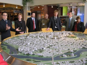
LeBreton Flats is a prominent 65 hectare riverfront site. The intent is to create, over the coming years, a vibrant and dynamic mixed-use community where people can work, live and play just minutes away from the Parliament buildings. The Flats will also be home to cultural and institutional buildings of national importance (Canadian War Museum), an abundance of open space and expansive riverfront land accessible to the visiting public.
|